I estimate Tehipite Valley gets 50 visitors a year. Probably fewer than 10,000 people have been there since California became a state. I’ve just returned from a five-day hike into the valley, and no-one else was there.
I knew it wasn’t going to be easy to get into Tehipite, so I was delighted when the lady at the ranger station where I picked up my wilderness permit told me that the trail had recently been maintained. This turned out to be true only for the first seven miles from the trailhead. After that, the trail hasn’t been maintained for many years. In some places it disappears under a blanket of shrubs. I frequently have to backtrack and check the map to pick it up again. The first seven miles take me a little more than three hours, but the last seven miles into the valley take me nine hours.
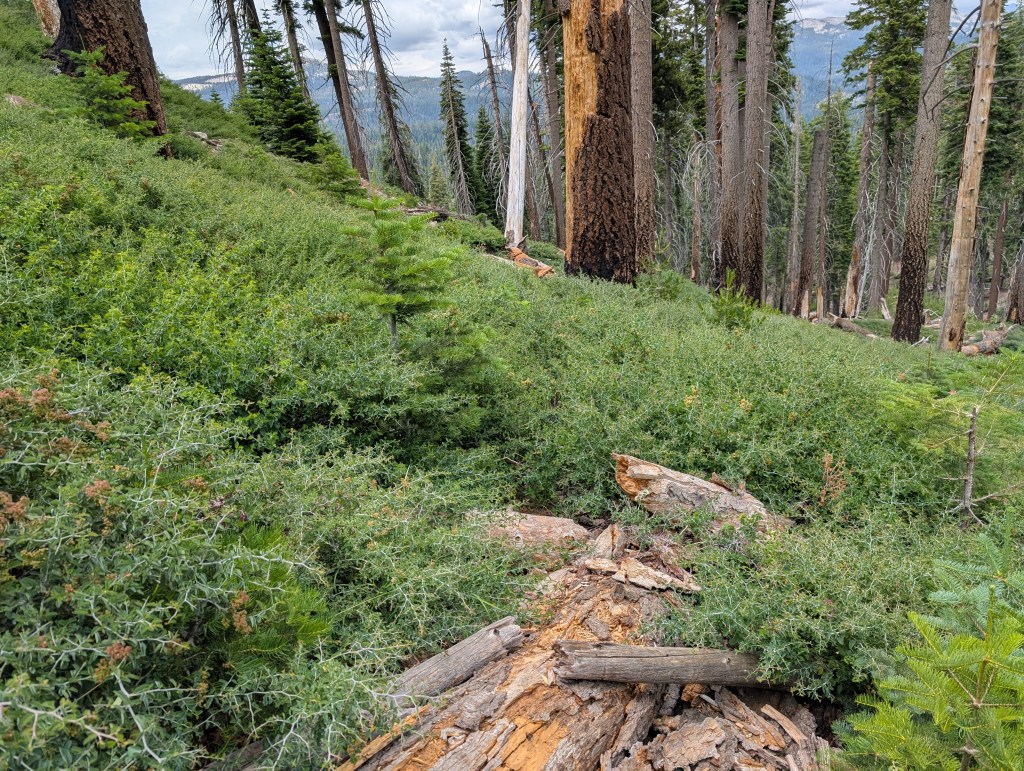
It’s not just that the trail to the valley is challenging, it’s also not pretty. The forest burned a few years ago, so there’s not much to look at except burned trees, logs and brush. There is a lot of dead wood, and when I step on a dry branch, a small splinter shoots up and hits me in the eye. Nothing a little crying couldn’t solve.
The first full frontal sight of Tehipite Dome, and arriving at the rim two and a half hours later, looking down into the valley with its green river, promises that this may be worth it.

The final descent is almost 3,000 feet. The condition of the trail doesn’t improve, but at least most of the time it’s now clear where it is. When I arrive on the valley floor almost three hours later, I’m looking forward to jumping into the turquoise Kings River I had seen from the rim, but I have to keep bushwhacking for another 30 minutes or so before I finally get access to the water. The last section crosses the largest blackberry patch I’ve ever seen. It’s thorny. Tehipite Valley? More like Tehipite jungle.
Finally the brush subsides. The valley is magnificent. Tehipite dome is gigantic, and I shout Wow! repeatedly on that first day whenever I see it. I find a spot to camp. There are a few fire rings, but no-one else is around. Not even bears: There’s some scat, but it’s dry. I had been worried about rattlesnakes, but I don’t see or hear any of those either. I don’t mind. My site is next to the creek, and the first thing I do is strip off and flop around like a fish in the shallow.

The next day I spend following the trail upriver, just taking some snacks and my fishing pole with me. They’re not as naive as I’d have assumed given how remote the river is, but I eventually I catch and release a few small trout. I also try to find the rock with Indian pictographs on it that I had marked on my map. My coordinates are inaccurate so I don’t find it, even though I spend an hour climbing around the boulder field where it must be. Apart from the hidden pictographs, the overgrown trail and the fire rings, there is no other sign of humanity. The valley, with its oak trees, would’ve been a good place for Native Americans to spend the summer, but I don’t know how much this actually happened.
If I continued on the trail for two days or three, it’d eventually join the John Muir trail. It may also be possible to follow Goddard creek, ten miles further up, all the way up to the Ionian Basin. I estimate this would take a week or more. Maybe some other time.
On my fourth day, and the third day in the valley, it’s time to head back. The sky is gray, it’s humid, and once I’m back on the plateau, it starts raining. This makes the mosquitos adventurous, or maybe just hungry.
Back on the well-maintained section and only three miles from the parking lot, I notice a bad smell. Looking up, I see a dead donkey leaning against a log. It had not been there on the way in, so it must’ve died in the last five days. Even so, its torso is already swollen and its backside has started to liquify. I guess it was a pack animal that had an injury and been left behind, even though I couldn’t see any sign that it had been shot.
Within twenty minutes of reaching my car at Rancheria trailhead, I’m sipping the second coffee of the day at Wishon Village store at the RV campground on the other side of Wishon Reservoir. The first one I had made myself after walking up in the wilderness earlier that morning.
That something as remote and pristine as Tehipite Valley exists in California in 2026 is miraculous. It could’ve been different: It could’ve been flooded like Hetch-Hetchy, or it could’ve become a crowded tourist destination like Yosemite, or the John Muir Trail. Instead, solitary Tehipite dome, the valley, its river, forests, sand banks and boulders have remained essentially untouched since the glaciers retreated more than 10,000 years ago.
Pointers
Here are my recommendations if you’re considering to visit Tehipite Valley:
- Google Maps has incorrect coordinates for the Rancheria trailhead. The correct coordinates are 36.97522, -118.95617.
- I often hike without poles, but I brought them on this trip and they were a great help clambering over felled trees, pushing aside poison oak and tapping the ground in front of me when I was worried about rattlesnakes.
- I’m glad I brought a headnet, but I wish I had also brought a loose-fitting, collared shirt because the mosquitoes were nuisance.
- I was sweating a lot in the 85-degree heat on the valley descent and especially on the ascent, and I’m glad I brought Nuun electrolyte tablets. I also like their flavors.
- Two items that made the trip more enjoyable were a lightweight hammock, which I used a lot to literally hang out in the valley, and a monocular to make the most of the views. I’d have used the hammock even more if there’d have been fewer mosquitoes.
- Because in places the trail has disappeared, I needed to check my position on my phone quite often. The trail coordinates on CalTopo and OpenStreeeMap are completely accurate. Have a look at this post for the app I use. Checking my position so often also meant that I used more battery than I anticipated. I was worried I’d run out before my return, in which case it’d be an ordeal finding my way back. I avoided this by keeping my phone on battery saver mode and switching it off whenever I didn’t need it, but having a spare power bank or even a solar charger would’ve been nice.
- Make sure you have the right coordinates for the painted rock. I only had the approximate location and I couldn’t find it.
- If you’re planning to spend more than a day in the valley, which you should, bring an aerial or satellite picture. The trail that runs along the North side of the valley floor is lovely, but in places the valley is a mile wide, and by sticking to it you’ll miss all that. A topographical map doesn’t show you which areas are passable and which aren’t, and an aerial picture will be more useful.
- The emphasis for Tehipite is on the second syllable, same than for Yosemite.

